Brookside-Ragala Road Junction: A Misty Hill-Country Crossroads of Old Ceylon
Brookside – Ragala Road Junction: Some places in Sri Lanka tell their story quietly. They are not famous monuments, grand hotels or restored colonial buildings. Sometimes, the story is found at a misty road junction, where an old signboard points towards tea estates, mountain villages and forgotten hill-country routes.
Brookside–Ragala Road Junction is one of those places.
Surrounded by mist, eucalyptus trees, tea slopes and narrow estate roads, this junction captures a deeply atmospheric side of Old Ceylon. It is not a destination that appears on most travel itineraries. Yet for anyone interested in colonial Ceylon, hill-country travel and the old estate world of Sri Lanka, it opens a fascinating story.
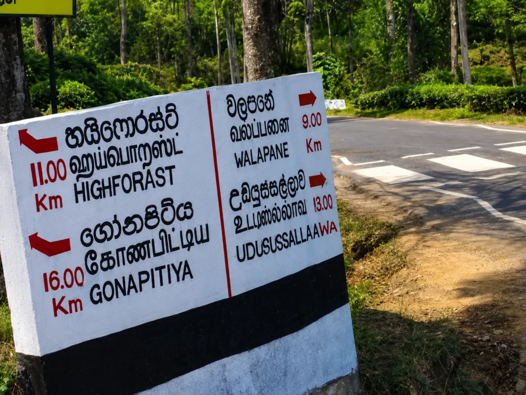
The road sign in the image points towards High Forest, Gonapitiya, Walapane and Udapussellawa. These are not just names on a board. They are part of the old tea-country geography of the central highlands, where roads connected estates, factories, villages, bungalows, markets and railway routes.
Check the previous article – https://trippingsrilanka.com/stories/badulla-sri-lanka
A Road Junction Wrapped in Mist
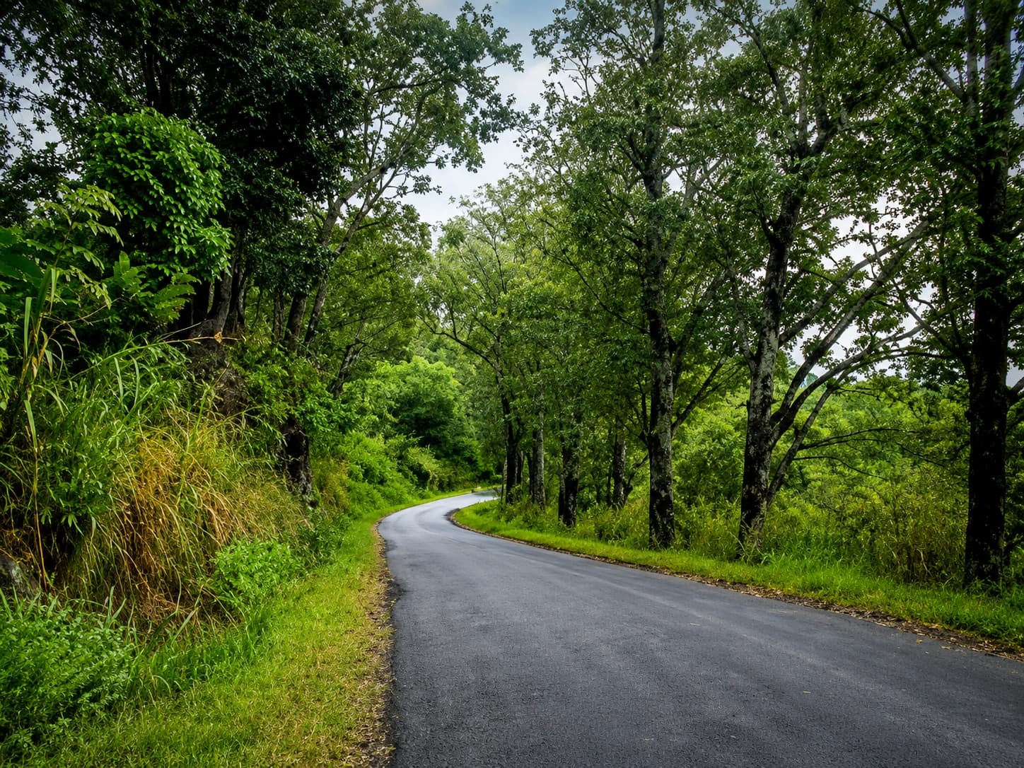
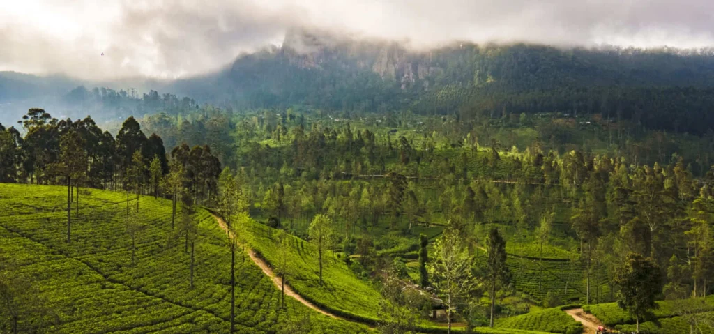
The first thing that strikes you about Brookside–Ragala Road Junction is the atmosphere. The road bends through a cool, misty landscape. Tall trees rise above the tea slopes. The air feels damp, quiet and far removed from the heat and noise of the lowlands.
This is the kind of place where Old Ceylon still feels close. Not because it has been preserved as a museum, but because the landscape itself carries memory. The road, the mist, the estate signs and the tea-covered hills all belong to a slower hill-country world.
In the image, the signboard gives four directions: High Forest, Gonapitiya, Walapane and Udapussellawa. Each name suggests a different route through tea country. Each road leads into a landscape shaped by British-era plantations, mountain settlement and the everyday lives of estate communities.
Brookside and the Tea Estate Landscape
Brookside is closely linked with the old tea estate world of Uda Pussellawa. Brookside Estate is recorded in tea estate history as having been established in the late nineteenth century. This places it within the great expansion of tea cultivation in British Ceylon.
The hill country changed dramatically during this period. After coffee plantations declined, tea became the crop that reshaped the central highlands. Forests, slopes and valleys were converted into estates. Roads were cut across mountains. Factories, bungalows, labour lines and estate villages appeared across the landscape.
Brookside belongs to this story. It is not simply a village name or a road marker. It is part of the plantation geography that made Ceylon tea famous around the world.
Ragala and the Uda Pussellawa Tea Country
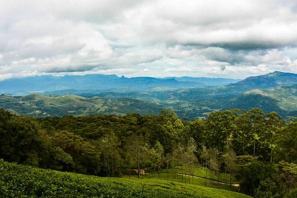
Ragala is one of the key names in the Uda Pussellawa tea region. This part of the hill country lies on the eastern side of the central mountains, between the Nuwara Eliya region, Walapane and the Uva-facing slopes.
Uda Pussellawa tea has its own character. The region is known for high-grown tea, mountain weather, cool winds and changing climatic conditions. Tea grown here is shaped by elevation, mist, rainfall and the distinct geography of the eastern hill slopes.
During colonial Ceylon, Ragala and the surrounding estate areas were connected to the wider tea economy through roads and, for a time, the Uda Pussellawa Railway. This narrow-gauge railway once linked Nanu Oya with Ragala and helped transport tea from the estates towards Colombo.
Today, the railway is gone, but the roads remain. Brookside–Ragala Road Junction is a small reminder of that older transport network.
High Forest: A Name That Carries the Hill-Country Mood
One direction from the junction points to High Forest. The name itself feels like a description of the landscape. High Forest is associated with the tea country around Uda Pussellawa and the cool mountain slopes of the central highlands.
For travellers, a road towards High Forest suggests exactly what the name promises: mist, tea fields, forest edges, estate roads and highland silence. This is not the manicured image of hill-country tourism. It is more rugged, local and atmospheric.
Places like High Forest help us understand that colonial Sri Lanka was not only made of famous towns like Nuwara Eliya and Kandy. It was also built through smaller estate districts, where tea factories, roads and workers’ settlements formed the real working world of Ceylon tea.
Walapane and the Interior Routes
Another road from the junction points towards Walapane. Walapane is part of the older inland geography of the Nuwara Eliya District. It connects the tea country with village settlements, valleys, temples, waterfalls and routes leading towards the eastern side of the hills.
The Walapane area gives this junction wider meaning. It shows that Brookside–Ragala was not only an estate road. It was part of a network connecting plantation country with older rural communities and administrative divisions.
In colonial times, such roads mattered deeply. They helped move tea, supplies, officials, estate workers and local produce. They also connected remote mountain communities to markets and towns. A junction like this was therefore practical, not decorative. It helped organise movement through difficult terrain.
Udapussellawa: A Forgotten Hill-Country Name
The sign also points towards Udapussellawa, one of the most evocative names in Sri Lanka’s tea history. Udapussellawa is often less discussed than Nuwara Eliya, Dimbula or Uva, but it has a strong identity within the world of Ceylon tea.
During British rule, the Udapussellawa region became known for high-grown tea estates scattered across steep and misty terrain. The old railway to Ragala helped support this tea economy in the early twentieth century, before it was eventually closed.
For today’s traveller, Udapussellawa offers a quieter hill-country experience. It does not have the tourist crowds of Ella or the formal “Little England” image of Nuwara Eliya. Instead, it has narrow roads, working estates, cool weather and the feeling of a region still closely tied to its plantation past.
The Old Roads of Colonial Ceylon
Brookside–Ragala Road Junction matters because it reminds us how important roads were in colonial Ceylon. Before modern highways, estate roads were lifelines. They carried tea leaves to factories, workers to estates, planters to bungalows and supplies into remote districts.
These roads were often difficult. Mist, rain, landslides and steep gradients made travel slow. But they were essential to the plantation economy. Without roads, tea could not move efficiently from field to factory, from factory to railway, and from railway to port.
The road junction in the image is therefore more than a scenic point. It is part of a historical system of movement. It belongs to the infrastructure that helped turn the central highlands into one of the world’s most famous tea-producing landscapes.
A Landscape of Estate Communities
The beauty of the Brookside–Ragala area should also be understood through the people who live there. The hill country was shaped not only by British planters and colonial companies, but also by generations of estate workers and their families.
Tamil estate communities played a central role in building and sustaining the tea industry. Their labour, culture, temples, schools, homes and everyday lives remain part of the hill-country landscape.
When travellers pass through Brookside, Ragala, High Forest or Udapussellawa, they are moving through a living estate world. Tea is not only scenery. It is work, history and community.
This is why slow travel matters here. The landscape should not be treated only as a backdrop for photographs. It should be approached with respect for the people and histories that made it.
Why This Junction Feels Like Old Ceylon
Some places feel historical even when there is no monument. Brookside–Ragala Road Junction has that quality. The misty road, the estate names, the multilingual signboard and the surrounding greenery all create the mood of Old Ceylon.
It feels like a place where travellers once paused to check direction before continuing through the hills. It feels like a road used by planters, estate lorries, schoolchildren, tea workers, local traders and families moving between villages.
The charm lies in its simplicity. A road sign. A bend. A tree. Mist. Tea country. That is enough to tell a story.
A Slow Travel Route Through the Area
For travellers exploring this part of Sri Lanka, Brookside–Ragala Road Junction can be part of a beautiful slow route through the hill country. The journey can connect Ragala, High Forest, Walapane, Udapussellawa, Kandapola and Nuwara Eliya, depending on the chosen direction.
This is not a route for rushing. The roads are narrow, scenic and often misty. The pleasure comes from stopping, looking, listening and allowing the landscape to unfold slowly.
Travellers can combine the route with tea estate views, waterfalls, village stops, local shops and quiet photography points. Early morning and late afternoon are especially atmospheric, when mist softens the road and the hills appear in layers.
Preserving the Memory of Hill-Country Roads
Sri Lanka’s heritage is often discussed through forts, churches, temples, railway stations and colonial hotels. But small road junctions also deserve attention. They tell us how people moved through the island and how landscapes were connected.
Old road signs, estate junctions, bridges and mileposts are part of the country’s historical memory. If they are ignored, painted over, removed or forgotten, a subtle but meaningful layer of heritage disappears.
Brookside–Ragala Road Junction is worth noticing because it represents the everyday infrastructure of colonial and post-colonial hill country life. It is not grand, but it is real.
Final Thoughts: Where the Mist Holds the Story
Brookside–Ragala Road Junction may seem like a simple roadside point, but it carries the atmosphere of a much larger story. It stands in a landscape shaped by tea estates, colonial roads, mountain weather, estate communities and the old routes of Uda Pussellawa.
For travellers searching for Old Ceylon, this is the kind of place that matters. It is quiet, misty and easy to overlook. Yet it speaks clearly of a time when roads through the hills connected plantations, villages and towns in a slow and practical rhythm.
The next time you pass a signboard like this in the hill country, stop for a moment. Read the names. Look at the road. Watch the mist move across the trees.
Sometimes, the deepest stories of colonial Sri Lanka are not found at the end of the journey. They are waiting at the junction.
FAQs About Brookside–Ragala Road Junction
Where is Brookside–Ragala Road Junction?
Brookside–Ragala Road Junction is in Sri Lanka’s central hill country, within the tea-growing landscape connected to Ragala, High Forest, Walapane and Udapussellawa.
Why is this road junction historically interesting?
It is interesting because it sits within the old tea estate road network of colonial Ceylon, where roads connected plantations, villages, factories and market towns.
What is Uda Pussellawa known for?
Uda Pussellawa is known as a high-grown tea region in Sri Lanka, with estates around Ragala, Maturata and related hill-country areas.
Is this area connected to colonial Ceylon?
Yes. The Brookside–Ragala area is connected to the plantation expansion, estate road systems and tea transport networks of British Ceylon.
Is Brookside–Ragala worth visiting?
Yes, especially for travellers interested in slow hill-country travel, tea estate scenery, photography, colonial Ceylon landscapes and lesser-known mountain routes.
Visit Us: https://trippingsrilanka.com/stories